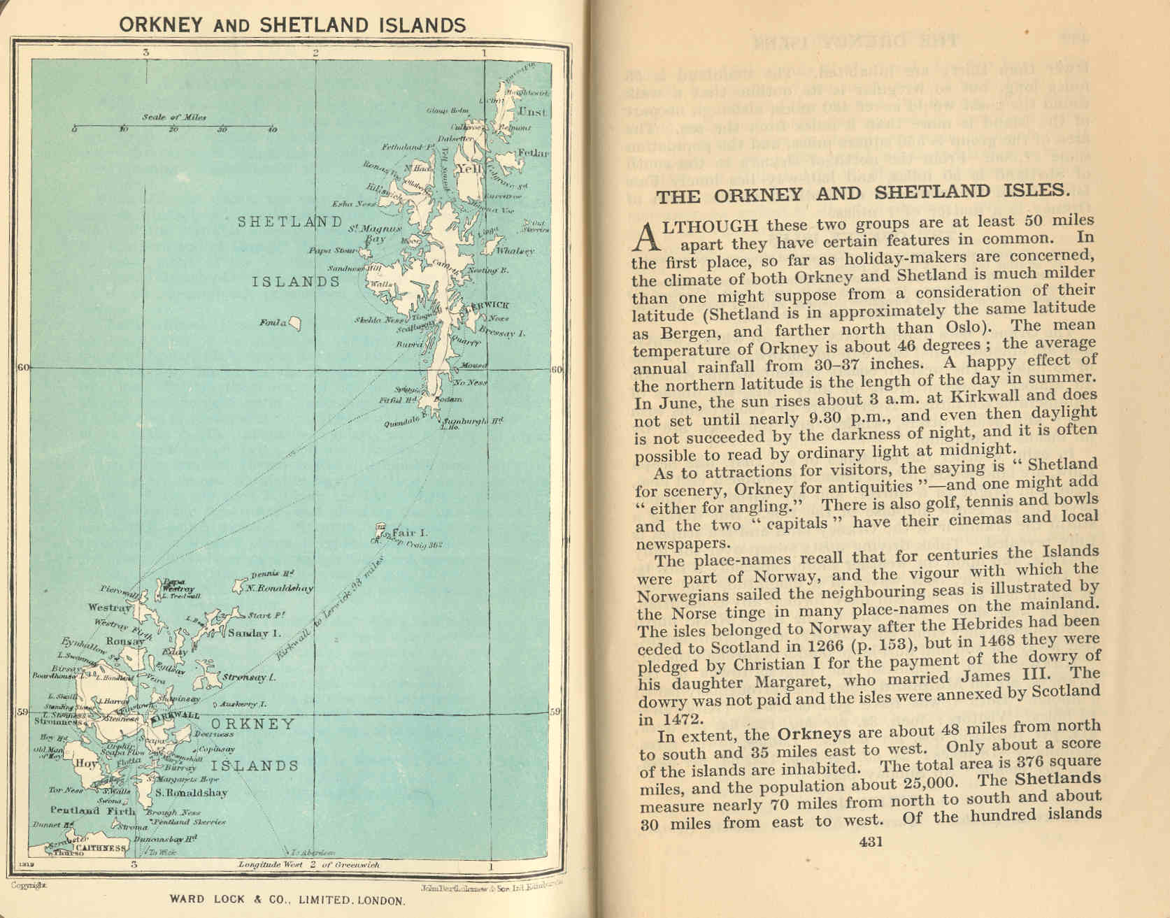
|
|
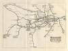
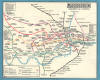
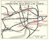
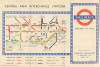
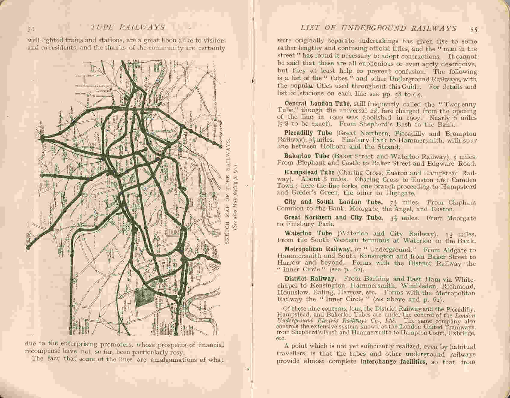
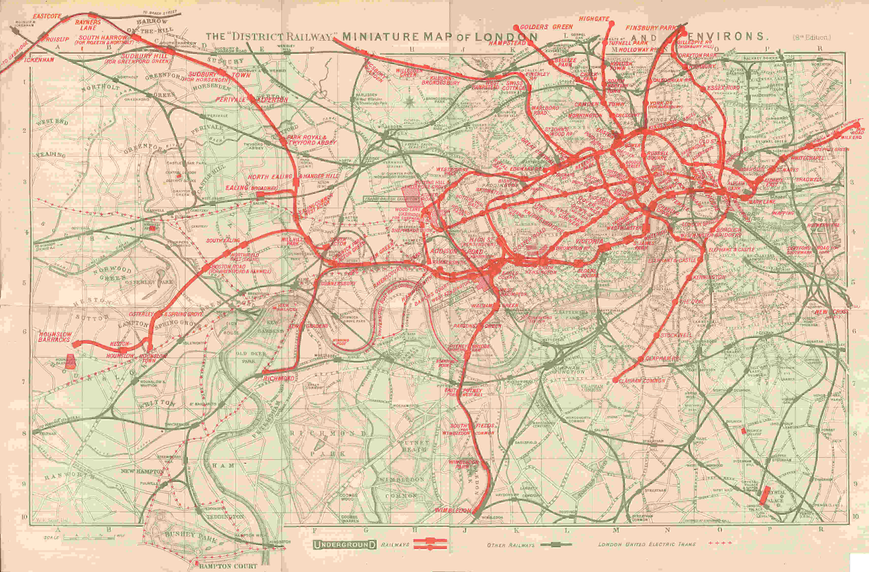
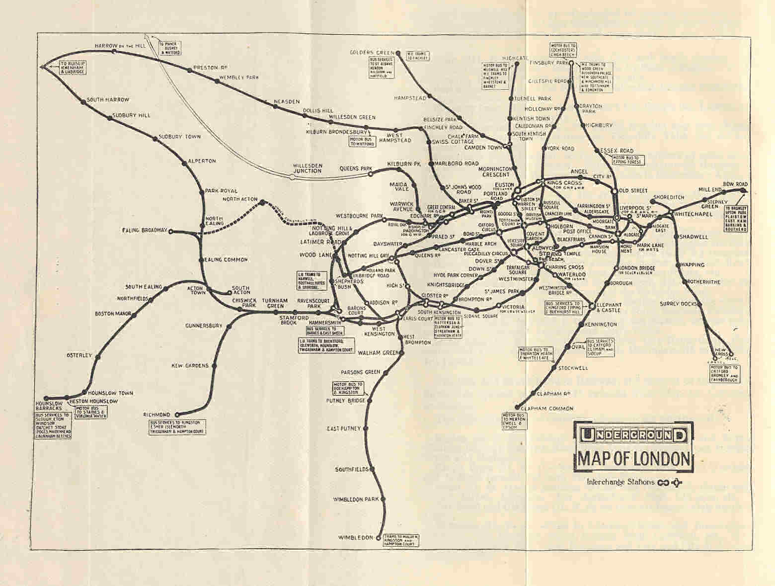
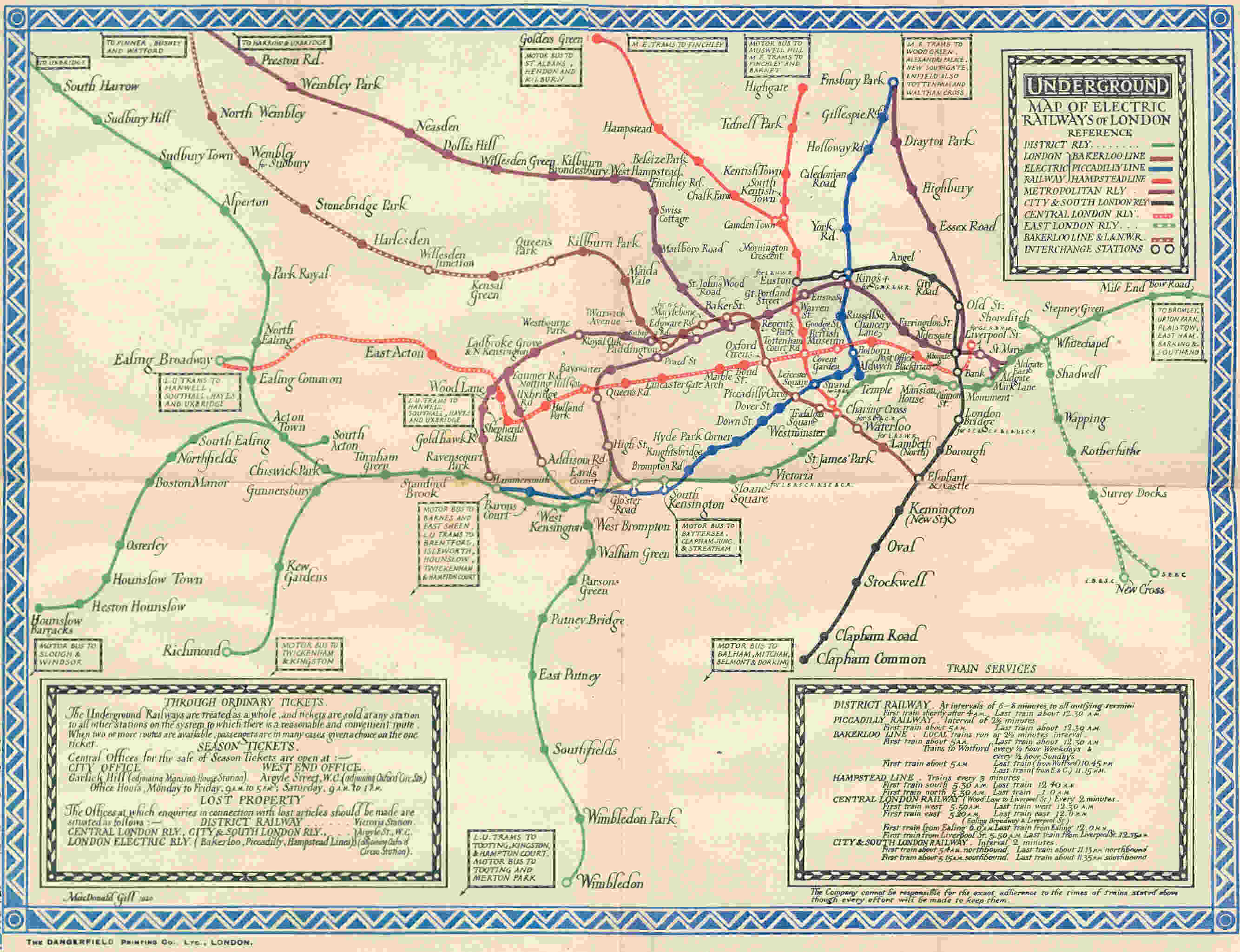
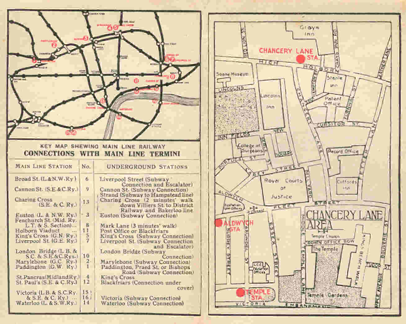
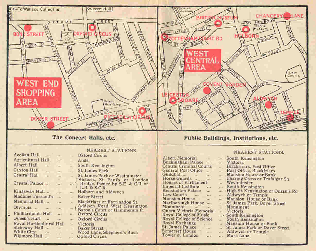
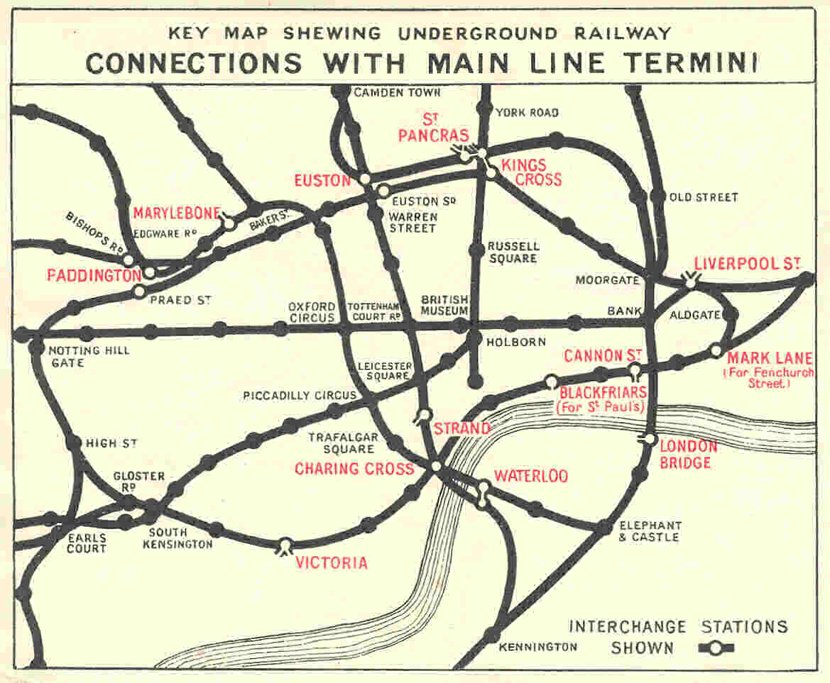
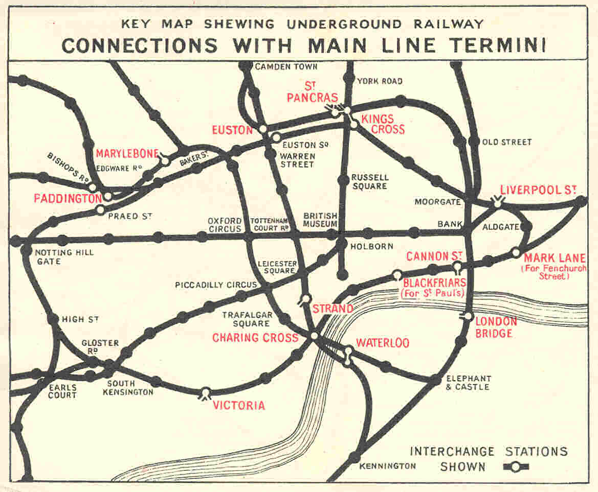
London Railway and Underground Maps The London Red Guides are distinguished by two features. Firstly, many of them have the date explicitly written in the title on the cover or spine. Secondly, as well as the usual fold-out maps, there were special maps for the railways of London and sometimes separately The London Underground or Tube Maps. These varied and evolved over the years. Some examples are listed here to illustrate:
Some further background information may be found at this link - London Underground Maps After Beck |
|---|
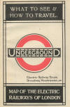
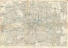
%20map_small.jpg)
%20map.jpg)